Bible Atlas
All the places in the Bible arranged alphabetically. Click the photos for more context.
All ‣ A ‣ B ‣ C ‣ D ‣ E ‣ F ‣ G ‣ H ‣ I ‣ J ‣ K ‣ L ‣ M ‣ N ‣ O ‣ P ‣ R ‣ S ‣ T ‣ U ‣ V ‣ W ‣ Y ‣ Z
Raamah
 Possible identifications: another name for Ragmat, Rgm, Regma
Ezek 27:22
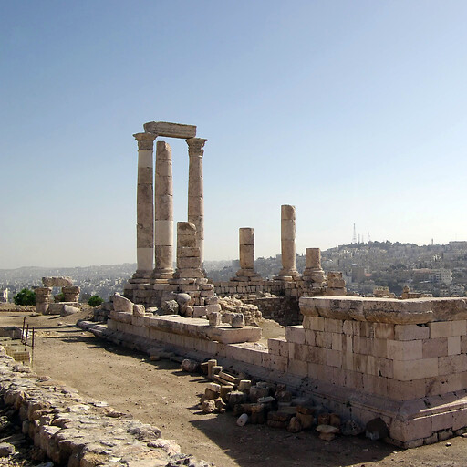
Rabbah 1
 Possible identifications: Amman
Deut 3:11, Josh 13:25, 2Sam 11:1, 12:26, 12:27, 12:29, 12:31, 17:27, 1Chr 20:1, 20:2, 20:3, Jer 49:2, 49:3, Ezek 21:20, 21:21, 25:5, Amos 1:14
Rabbah 2
 Possible identifications: Khirbet Hamideh, within 7 km of Kiriath-jearim, Horbat Darban, Tell el Kokah
Josh 15:60
Rabbith
 Possible identifications: another name for Daberath, Raba, Arabbuna
Josh 19:20
Racal
 Possible identifications: another name for Carmel 1
1Sam 30:29
Rakkath
 Possible identifications: Tel Raqqat, another name for Tiberias, Khirbet el Fuliya, another name for Kartan
Josh 19:35
Rakkon
 Possible identifications: Tell er Reqqeit, Ayalon River, not a place (scribal error), Tel Gerisa, Yarkon River
Josh 19:46
Ramah 1
 Possible identifications: Al Ram, Ramallah, Ramat Rahel
Josh 18:25, Judg 4:5, 19:13, 1Kgs 15:17, 15:21, 15:22, 2Chr 16:1, 16:5, 16:6, Ezra 2:26, Neh 7:30, Isa 10:29, Jer 31:15, 40:1, Hos 5:8, Matt 2:18
Ramah 2
 Possible identifications: Ramyah, Rameh, another name for Ramah 3
Josh 19:29
Ramah 3
 Possible identifications: Khirbet Zeitun er Rameh, Er Rameh
Josh 19:36
Ramah 4
 Possible identifications: another name for Ramah 1, Al Ram, Beit Rima, Ramallah, Nabi Samwil, Rantis
1Sam 1:19, 2:11, 7:17, 8:4, 15:34, 16:13, 19:18, 19:19, 19:22, 19:23, 20:1, 25:1, 28:3
Ramah 5
 Possible identifications: another name for Ramoth-gilead
2Kgs 8:29, 2Chr 22:6
Ramah 6
 Possible identifications: another name for Baalath-beer, Tel Ira, Horbat Uza, another name for Ramath-lehi
Josh 19:8
Ramah 7
 Possible identifications: another name for Ramah 1, Rameh, another name for Ramah 4
Neh 11:33
Ramah 8
 Possible identifications: within 1 km of Gibeah 1
1Sam 22:6
Ramah 9
 Possible identifications: another name for Ramah 1, another name for Ramah 2, another name for Ramah 3, another name for Ramah 6, another name for Ramah 4, another name for Ramah 5
1Chr 27:27
Ramath-lehi
 Possible identifications: another name for Lehi
Judg 15:17
Ramath-mizpeh
 Possible identifications: Jel‘ad, another name for Mizpah 1, another name for Ramoth-gilead, Khirbet el Qar’a, Khirbet Sara, Iraq al Amir
Josh 13:26
Ramathaim-zophim
 Possible identifications: another name for Ramah 4, another name for Arimathea, Rantis
1Sam 1:1
Rameses
 Possible identifications: Qantir, Tell el Daba, another name for Pelusium, Tanis
Gen 47:11, Exod 1:11, 12:37, Num 33:3, 33:5
Ramoth 1
 Possible identifications: Kokab el Hawa, another name for Remeth
1Chr 6:73
Ramoth 2
 Possible identifications: another name for Ramah 6
1Sam 30:27
Ramoth 3
 Possible identifications: another name for Ramoth-gilead
Deut 4:43, Josh 20:8, 21:38, 1Chr 6:80
Ramoth-gilead
 Possible identifications: Tall er Rumeith, Ar Ramtha, As Salt, Iraq al Amir, Tall al Husun
1Kgs 4:13, 22:3, 22:4, 22:6, 22:12, 22:15, 22:20, 22:29, 2Kgs 8:28, 9:1, 9:4, 9:14, 2Chr 18:2, 18:3, 18:5, 18:11, 18:14, 18:19, 18:28, 22:5
Recah
 Possible identifications: within 5 km of Bethlehem 1, not a place (person)
1Chr 4:12
Red Sea 1
 Possible identifications: Gulf of Suez, Bitter Lakes, Lake Timsah, Ballah Lakes, Gulf of Aqaba, Pelusiac branch of the Nile, Lake Manzala, Lake Bardawil
Exod 13:18, 15:4, 15:22, Num 33:8, Deut 11:4, Josh 2:10, 4:23, 24:6, Neh 9:9, Ps 66:6, 77:16, 106:7, 106:9, 106:22, 114:3, 114:5, 136:13, 136:15, Isa 63:11, Acts 7:36, Heb 11:29
Red Sea 2
 Possible identifications: Gulf of Aqaba
Exod 23:31, Judg 11:16, 1Kgs 9:26, 2Chr 8:17, Jer 49:21
Red Sea 3
 Possible identifications: Gulf of Suez, another name for the Red Sea 1, Gulf of Aqaba
Exod 10:19, Num 33:10, 33:11
Rehob 1
 Possible identifications: another name for Beth-rehob, another name for Rehob 3, another name for Rehob 2
Num 13:21, 2Sam 10:8
Rehob 2
 Possible identifications: Tell el Balat, Tell er Rahb, another name for Rehob 3, Tell Bir el Gharbi, another name for Rehob 1, Horbat Kenesiyya
Josh 19:28
Rehob 3
 Possible identifications: Tell Bir el Gharbi, another name for Rehob 2, Khirbet Da‘uk
Josh 19:30, 21:31, Judg 1:31, 1Chr 6:75
Rehoboth 1
 Possible identifications: Ruheibeh
Gen 26:22
Rehoboth 2
 Possible identifications: Ras Rihab, within 20 km of Wadi Ghuwayr, Khirbet Musrab, Al Rahba
Gen 36:37, 1Chr 1:48
Rehoboth-Ir
 Possible identifications: in Nineveh, another name for Nineveh, in Calah, another name for Asshur
Gen 10:11
Rekem
 Possible identifications: within 5 km of Irpeel, Feldstein et al Site 43, Feldstein et al Site 34, Khirbet el Burj
Josh 18:27
Remeth
 Possible identifications: another name for Ramoth 1, Kokab el Hawa, En haYadid, Khirbet ed Dir
Josh 19:21
Rephidim
 Possible identifications: along Wadi Rufaiyil, along Wadi Feiran, along Wadi el Sheikh, Jabal Huwayti, along Wadi Sudr
Exod 17:1, 17:8, 19:2, Num 33:14, 33:15
Resen
 Possible identifications: not a proper name (public work in or near Nineveh or Calah), Qaryat as Salamiyah, Hamam al Alil, Resh Eni
Gen 10:12
Rezeph
 Possible identifications: Resafa, Resappa
2Kgs 19:12, Isa 37:12
Rhegium
 Possible identifications: Reggio Calabria
Acts 28:13
Rhodes 1
 Possible identifications: Rhodes, Acropolis of Rhodes
Acts 21:1
Rhodes 2
 Possible identifications: Rhodes
Ezek 27:15
Riblah 1
 Possible identifications: Rableh
2Kgs 23:33, 25:6, 25:20, 25:21, Jer 39:5, 39:6, 52:9, 52:10, 52:26, 52:27, Ezek 6:14
Riblah 2
 Possible identifications: Arbin, Tall Irbid, Hermel, another name for Riblah 1
Num 34:11
Rimmon 1
 Possible identifications: El Jai Cave, Rammun, along Wadi Rummananeh, plateau east of Rammun
Judg 20:45, 20:47, 21:13, Isa 10:27
Rimmon 2
 Possible identifications: Tel Halif, Khirbet Umm er Rammamin
Josh 15:32, 19:7, 1Chr 4:32, Zech 14:10
Rimmon 3
 Possible identifications: Rumana, Horbat Rumah, Qarn Hattin, Tel Hanaton
Josh 19:13
Rimmon-perez
 Possible identifications: along Naqb al Biyar, along Wadi er Rummun, another name for Rimmon 2
Num 33:19, 33:20
Rimmono
 Possible identifications: another name for Rimmon 3
1Chr 6:77
Rissah
 Possible identifications: Sharma, Kuntilet el Jerafi
Num 33:21, 33:22
Rithmah
 Possible identifications: along Wadi Ratamah, along Wadi Abu Retemat, along Wadi er Retame, Ain Rathmah, Bir es Sawra
Num 33:18, 33:19
River 2
 Possible identifications: another name for the Euphrates, another name for the Jordan 1, another name for the Jabbok
Num 22:5
River 3
 Possible identifications: another name for the Zered, not a proper name (common noun for "river"), Wadi Ghuwayr, another name for the Brook of Egypt, Wadi Rihab, another name for the Euphrates
Gen 36:37, 1Chr 1:48
Rock of Escape
 Possible identifications: along Wadi Malaqi
1Sam 23:28
Rogelim
 Possible identifications: Zaharet, Tell Barsina
2Sam 17:27, 19:31
Rome
 Possible identifications: Rome
Acts 2:10, 18:2, 19:21, 19:40, 23:11, 25:25, 25:27, 28:14, 28:15, 28:16, 28:30, Rom 1:7, 1:15, 15:24, 2Tim 1:17
Rumah
 Possible identifications: Horbat Rumah, another name for Arumah, another name for Adoraim, Deir ed Domeh, another name for Dumah 1
2Kgs 23:36
Image Credits
Mohammad Umair Yaqub, Berthold Werner, AVRAMGR, Tamir Bejerano, Bukvoed, אסף שגיא, Вячеслав Ребров, Soman, Oren1973, Contains modified Copernicus Sentinel data 2019, Eli.berckovitz, Sailko, אסף.צ, Lior Golgher, Berthold Werner, youssef_alam, mikkelsaar, Rasmus Bøgeskov Larsen, Aaadir, zstadler, Osama Shukir Muhammed Amin FRCP(Glasg), Haubi|Gerhard Haubold, Enric, Karelj, Waseem Al Sakhleh, Danny Gershoni, Almog, Ferrus, Adeeb Atwan, hatul, Chalaph, דותן דני