Map Overlays for Google Earth
Historical maps give you insights you can’t get from satellite imagery alone. (Adjust the transparency and turn on the terrain layer for the best effects.)
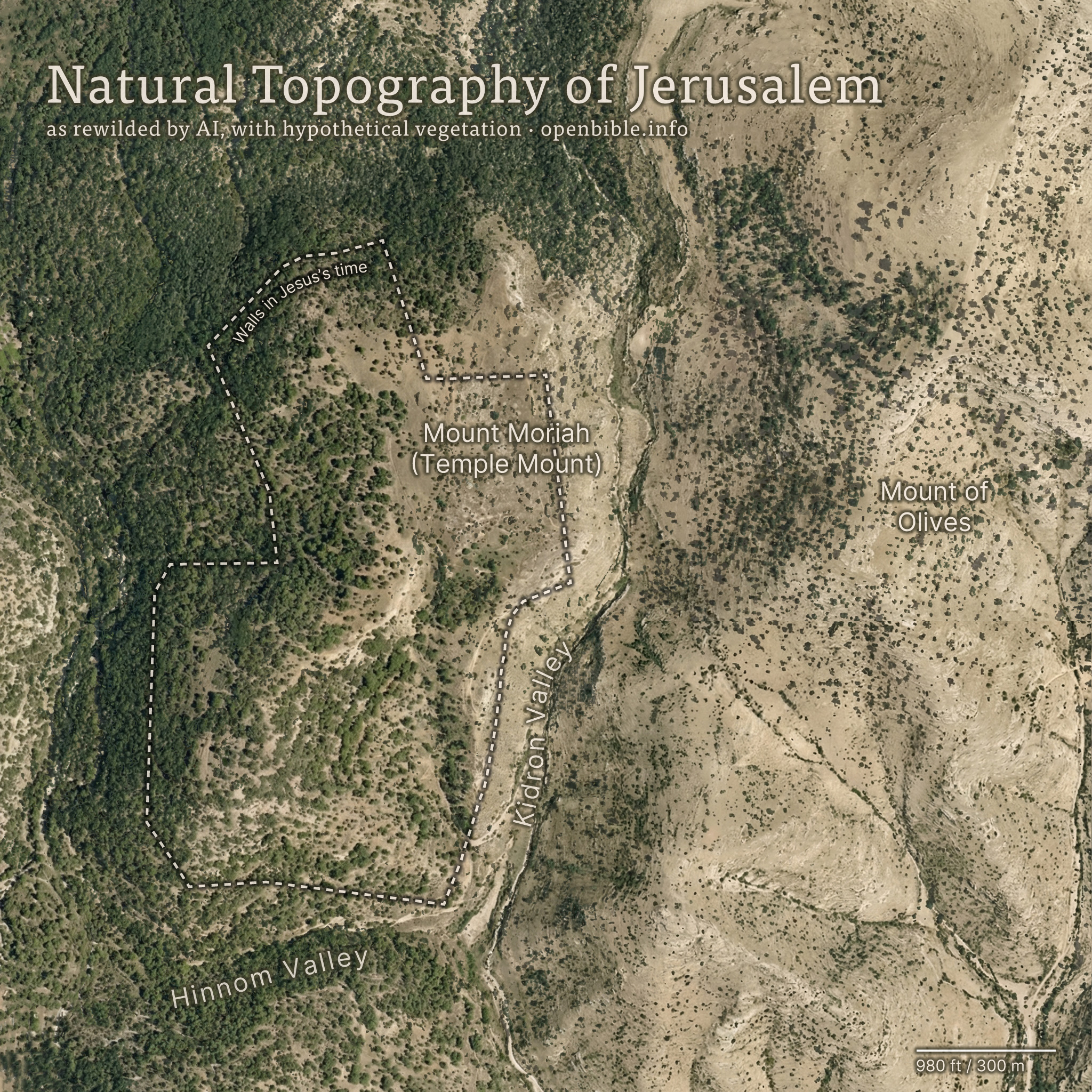
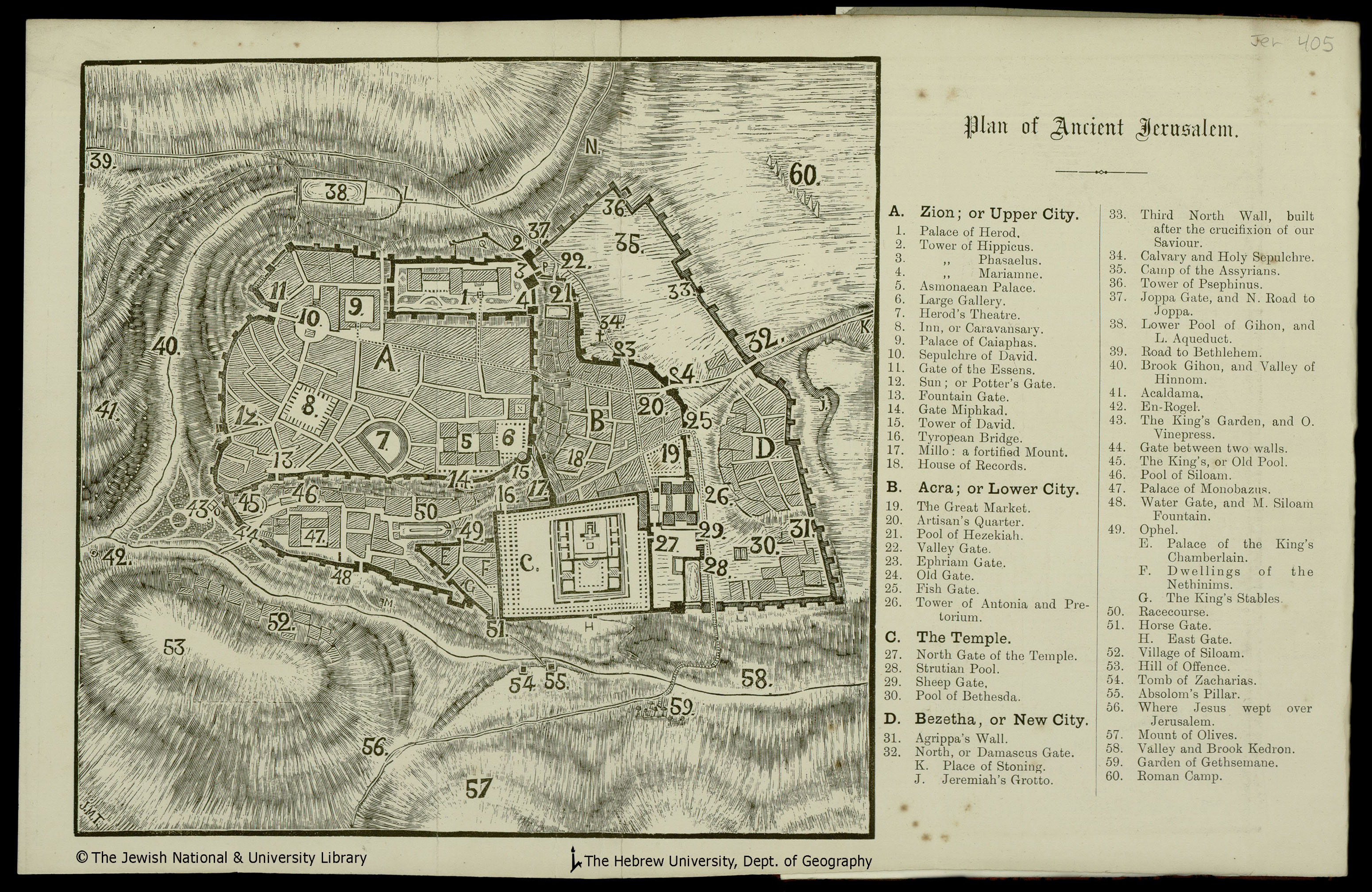
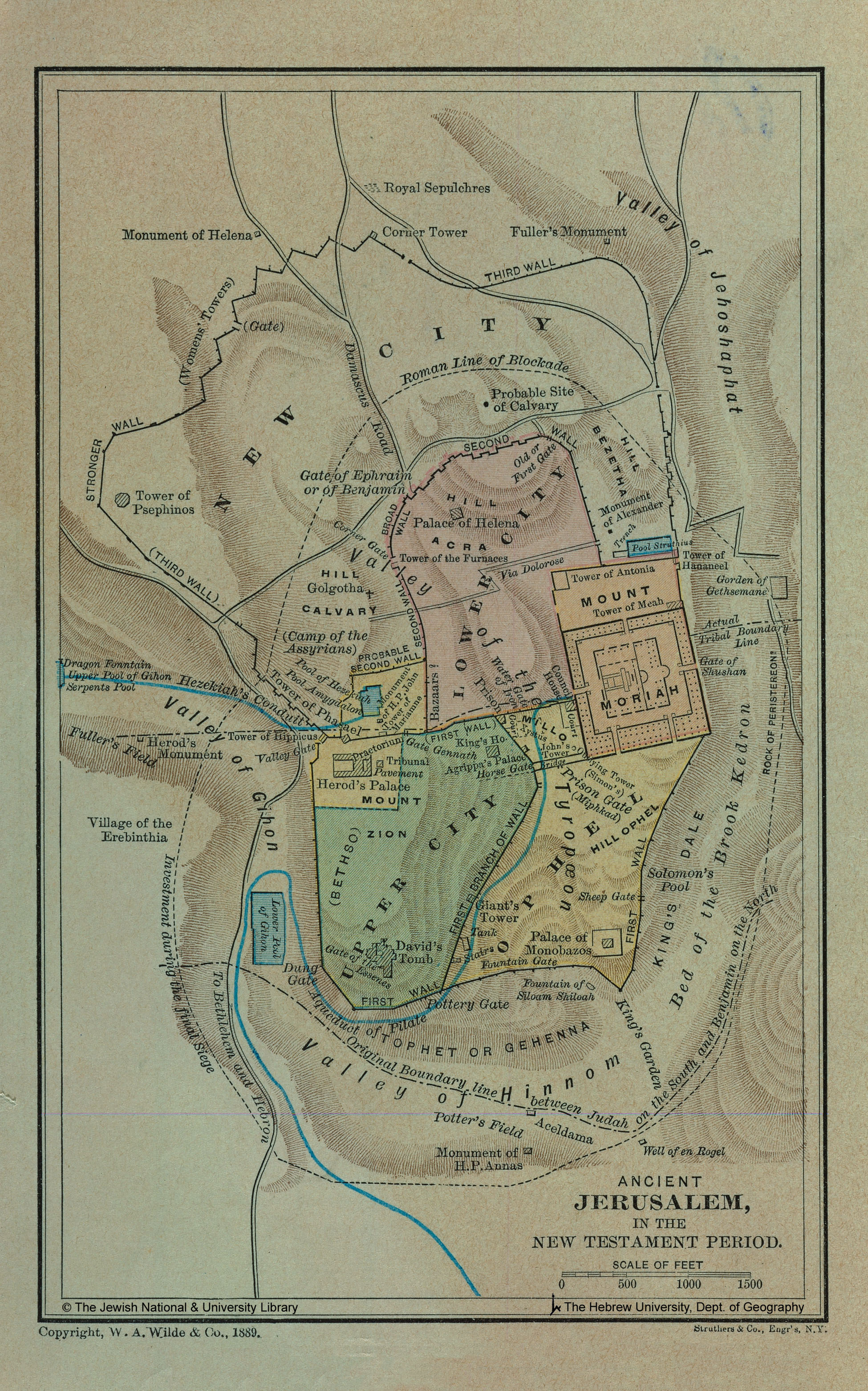
Jerusalem
Google Earth (KML, no preview available)

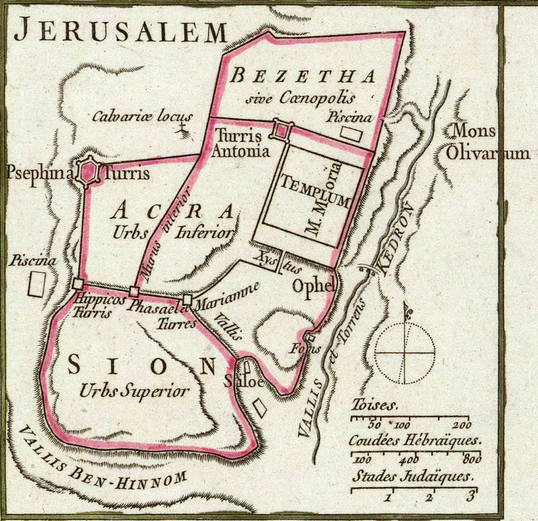
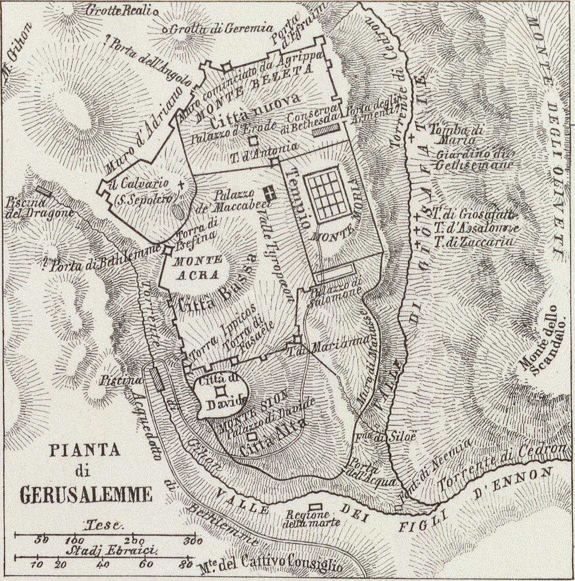
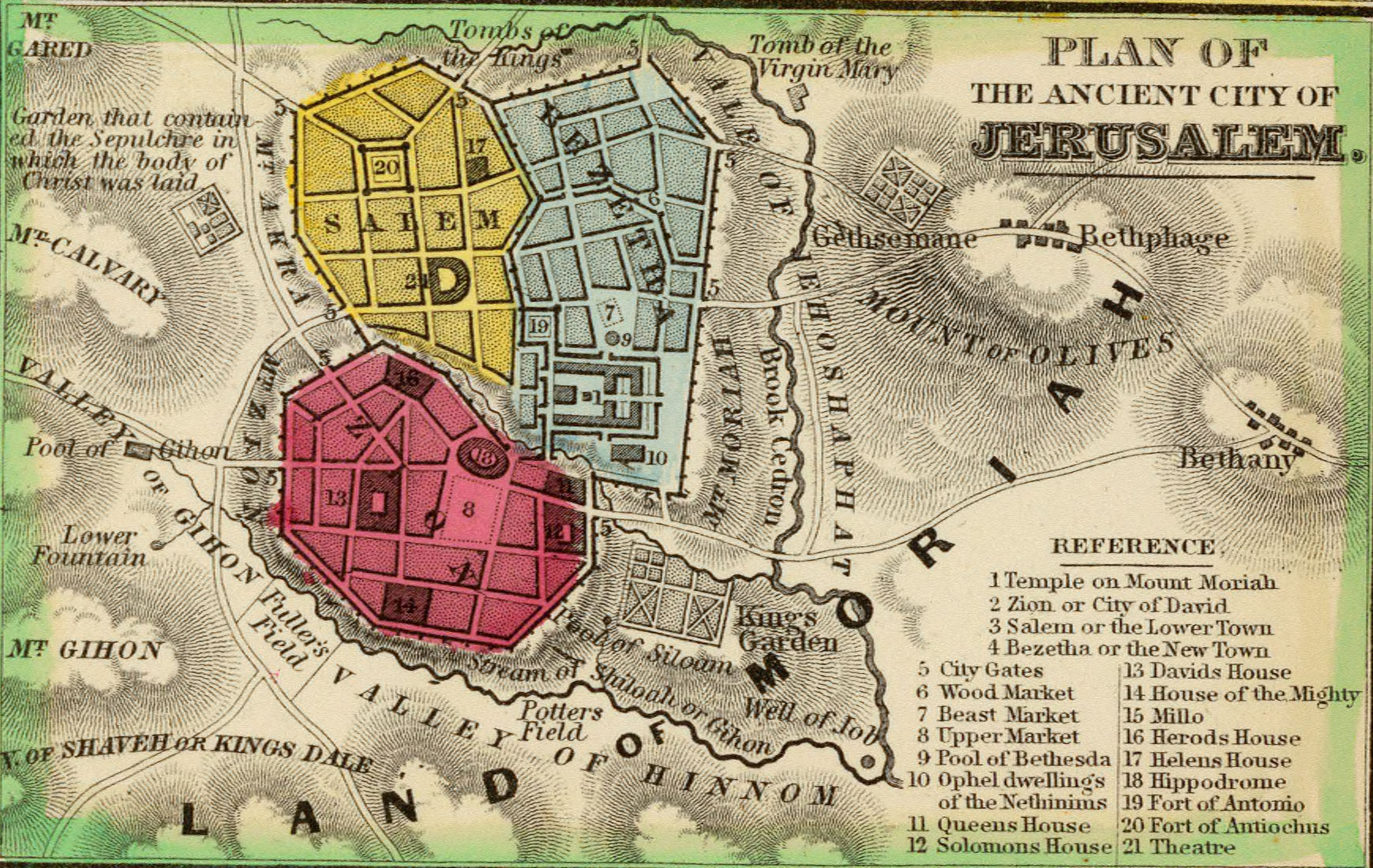
Ancient Jerusalem
Snapshots of the overlays in the above Google Earth file:


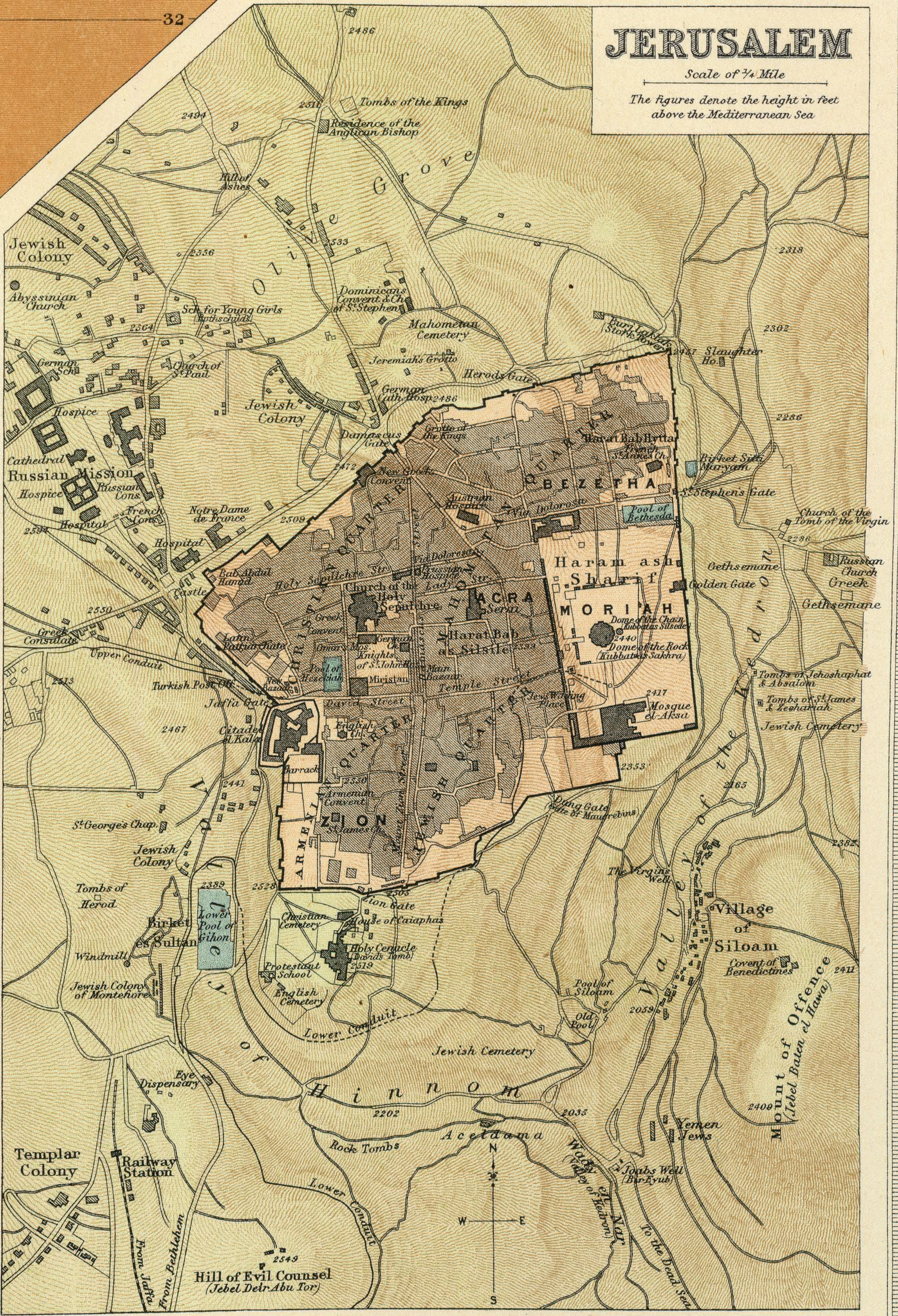
Modern Jerusalem
Snapshots of the overlays in the above Google Earth file:


Credits
Most images copyright ©2000 by Cartography Associates. From the David Rumsey Map Collection, David Rumsey Map Center, Stanford Libraries. Other images are copyright The Jewish National & University Library, Shapell Family Digitization Project, Eran Laor Cartographic Collection and The Hebrew University of Jerusalem, Dept. of Geography, Historic Cities Project. Used with permission. Please note that the images may be made available under different terms from most of the rest of the site. See the KML file for full attribution.