Places in the Bible Today:
Negeb
Data
| Translated Names | Negeb, Negev, Ramoth-negev, South, southern Judah, southern part of Judah |
|---|---|
| Type | region |
| Notes | Negeb in the Bible refers to the northern part of the modern Negev, north of the Wikidata point |
| Geo Data |
KML (for Google Earth) GeoJSON (for GIS applications) |
1 Identification
- Negeb (ancient): very high confidence
Verses (43)
- Gen-Deut (13)
- Gen 12:9, 13:1, 13:3, 20:1, 24:62, 25:11
- Num 13:17, 13:22, 13:29, 21:1, 33:40
- Deut 1:7, 34:3
- Josh-Ruth (11)
- Josh 1:4, 10:40, 11:16, 12:8, 15:1, 15:19, 15:21, 19:8
- Judg 1:9, 1:15, 1:16
- 1Sam-Esth (6)
- 1Sam 27:10, 30:1, 30:14, 30:27
- 2Sam 24:7
- 2Chr 28:18
- Job-Mal (13)
- Ps 126:4
- Isa 21:1, 30:6
- Jer 13:19, 17:26, 32:44, 33:13
- Ezek 20:46, 20:47, 47:19, 48:28
- Obad 19, 20
Linked Data Identifiers
| Source | Identifier |
|---|---|
| Biblemapper.com | negev |
| Logos Factbook | Negeb |
| OpenBible.info (2007) | Negeb |
| OpenBible.info | a1cb244 (Negeb) |
| Pleiades | 687985 |
| TIPNR | Negeb@Gen.12.9 |
| UBS Names Database | ot ID_1928 |
| Wikidata | Q162843 |
Sources
- Baker Book of Bible Charts, Maps, and Time Lines (2016)
- Barnes, Historical Atlas of the Bible (2010)
- Biblica: The Bible Atlas (2007)
- CEB Bible Map Guide (2011)
- Discovery House Bible Atlas (2015)
- ESV Bible Atlas (2010)
- HarperCollins Concise Atlas of the Bible (1991)
- Harvest Handbook of Bible Lands (2019)
- Holman Bible Atlas (1999)
- Holman Illustrated Guide to Bible Geography (2020)
- Hudson, Bible Atlas and Companion (2008)
- IVP Atlas of Bible History (2006)
- Kregel Bible Atlas (2003)
- National Geographic, The Biblical World (2007)
- New Bible Atlas (1985)
- New Moody Atlas of the Bible (2009)
- Oxford Bible Atlas, Fourth Edition (2007)
- Penguin Historical Atlas of the Bible Lands (2009)
- Reader’s Digest Atlas of the Bible (1981)
- Sacred Bridge (2014)
- Schlegel, Satellite Bible Atlas (2016)
- Student Bible Atlas (2015)
- Tübingen Bible Atlas (2001)
- Zondervan Atlas of the Bible (2010)
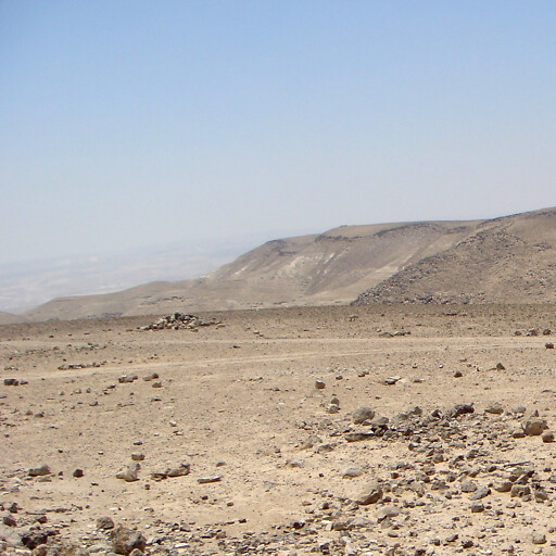
Image

Credit: ליאור גולגר (modified)
About
This page identifies the current consensus around the modern location of this biblical place.
The isobands you see on the map (gray areas with dark borders) attempt to give you confidence where a region is. Because many ancient regions aren't precisely defined, I consulted atlases to determine where the biblical region is located and used that data to build the isobands. The smaller isobands reflect more confidence that the given isoband is in the region, while the larger isobands reflect less confidence. Isobands are a kind of contour line that here indicate confidence levels.
